GPS came up in the live chat, so I’ve been digging in a bit this morning.
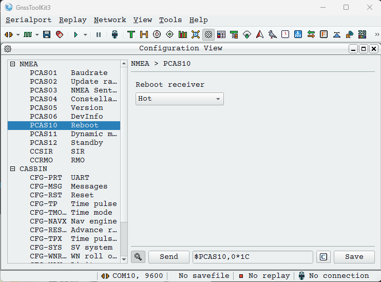
The GnssToolKit3 is a good reference to decoding NMEA and also configuring the gps module. This can be used through the Bus Pirate bridge command in UART mode.
Of course, the Bus Pirate also has a gps command in UART mode to decode common NMEA sentences in the terminal.
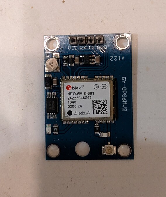
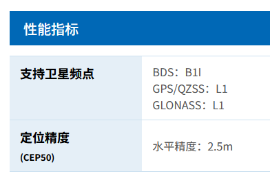
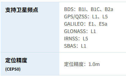
I have one of these, looks like an ATGM336H-5N-31-0, this appears to be the datasheet.
| Description | PCAS | Command | |
|---|---|---|---|
| save configuration | $PCAS00*01 | ||
| hot restart | $PCAS10,0*1C | ||
| cold restart | $PCAS10,2*1E | >“$PCAS10,2*1E” 0x0d 0x0a | |
| factory reset | $PCAS10,3*1F | >“$PCAS10,3*1F” 0x0d 0x0a | |
| stationary mode | $PCAS11,1*1C | ||
| GPS Only | $PCAS04,1*18 | ||
| BSD Only | $PCAS04,2*1B | ||
| GPS+BDS | $PCAS04,3*1A | ||
| GPS+GLONASS | $PCAS04,5*1C | ||
| 115200 Baud | $PCAS01,5*19 | >“$PCAS01,5*19” 0x0d 0x0a | |
| 0.2 Hz | $PCAS02,5000*2A | >“$PCAS02,5000*2A” 0x0d 0x0a |
According to this page it accepts “$PCAS” instructions for configuring baud rate, sample speed and other stuff. I have not used these before, and searching around it seems uncommon.
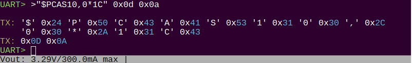
I was able to hot reset and change the baud rate.
One huge issue seems to be that I just bought a tiny/cheap GPS on Taobao, and with that comes complete lack of proper documentation.
Is there a well built, well documented module that might be a better option?
Trying the module with GnssToolKit
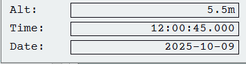
Out the window, after about 2 minutes, I get time and date info. Nice! 5.5m is probably not right, I am almost certainly ~2m below sea level on the ground floor here (according to the water level display at city hall).
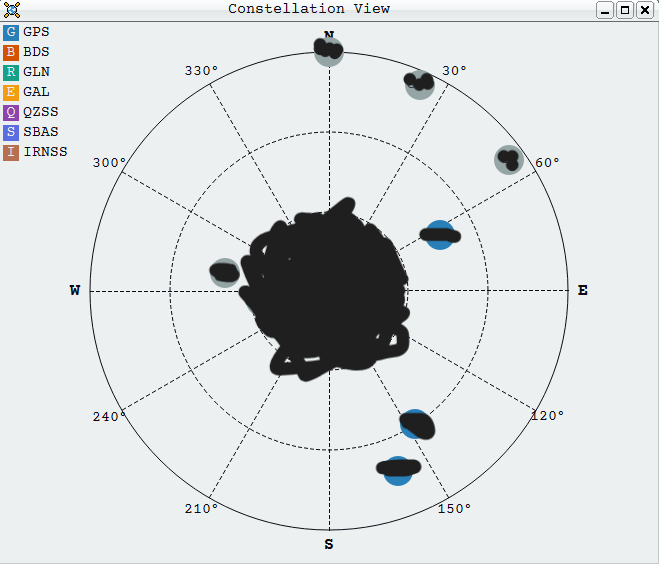
When it gets a lock the constellation view is very cool. However, it only sees a few satellites compared to my phone (36!).